Free GIS toolbox to easily analyze geographic data


In the field of GIS (geographic information system), data processing and visualization are often a headache: format conversion is cumbersome, service publishing charges are high, and the operation threshold is difficult to cross. However, a domestic software called GISBox has quietly become an “efficiency artifact” for small and medium-sized enterprises and individual developers with its free, open, comprehensive and user-friendly features. This article will start from the actual application scenario and show you how GISBox breaks the limitations of traditional GIS tools.
1. Why choose GISBox?
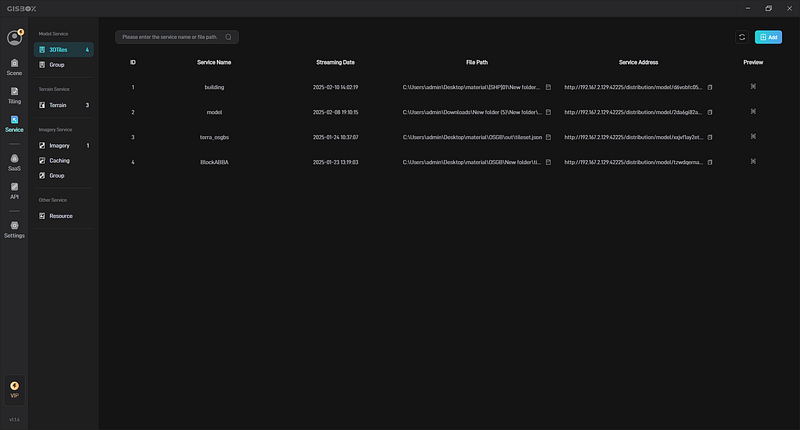
The core concept of GISBox is “making GIS data processing easier”, and its biggest highlight is the completely free service publishing function. Although traditional GIS tools such as ArcGIS are powerful, the high licensing fees make many users discouraged. GISBox is not only free, but also supports the one-click publishing of processed data in mainstream protocols such as 3DTiles, Terrain, and WMTS. The generated online services can be directly used in platforms such as Shanhaijing Visualization, saving the cost of building a server.
What’s more rare is that the free version of GISBox is not a “castrated version” — from data import, editing to publishing, the full process functions are open, especially suitable for projects with limited budgets but need to be implemented quickly.
2. Four core functions to solve the “pain points” of GIS users
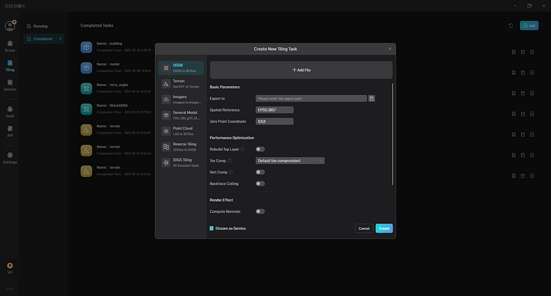
1) One-stop format conversion: say goodbye to cumbersome software switching
GIS data formats are varied (such as OSGB, PVT, GEO-TIFF, etc.), and traditional processing requires multiple tools. GISBox supports one-click conversion of various formats, such as converting OSGB files of oblique photography to the 3DTiles format commonly used on the Web, or converting terrain data to Terrain format, greatly reducing the time-consuming intermediate links.
2) Real-time editing of oblique photography: repairing broken surfaces and simulating terrain with just a few clicks
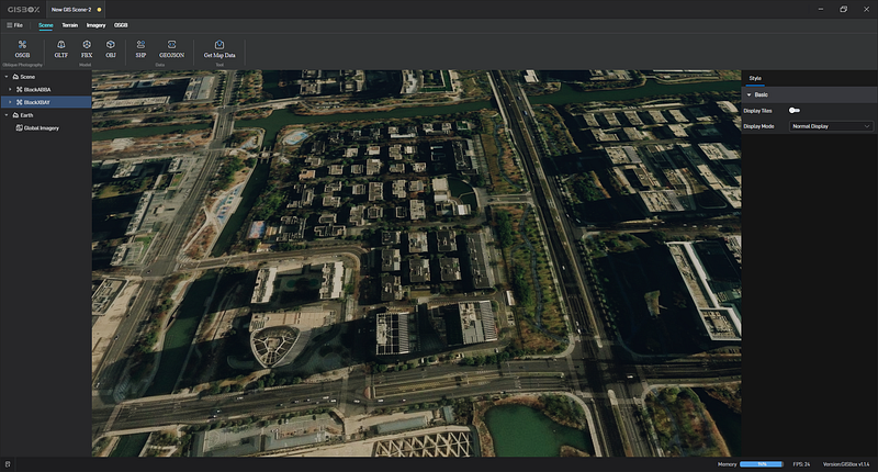
Oblique photography data often has “broken surfaces” or does not match the terrain due to collection problems. GISBox provides practical tools such as broken surface repair, riverbed depression, and terrain alignment. Users do not need to export to other software, and can directly drag and adjust in the interface to complete the repair, significantly improving the quality of data visualization.
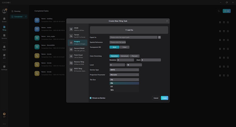
3) Custom slice optimization: make map loading speed take off
The default size of traditional map tiles is 256×256, but when displayed on a large screen, it may cause freezes due to too many requests. GISBox allows custom tile sizes (such as 512×512 or 1024×1024), reducing the number of requests and improving loading efficiency.
4) Cross-platform compatibility: Windows/Mac/Linux fully supported
Whether it is an enterprise user or an individual developer, GISBox can be used smoothly in a familiar operating system to avoid work interruptions caused by system limitations.
3. Wide application and significant results
GISBox has a wide range of applications in many fields. In the field of environmental protection, it can provide data support for ecological protection by analyzing geographic data and monitoring ecological environmental changes. In the agricultural field, GISBox can be used to analyze geographic information such as soil fertility and climate conditions to achieve precision agriculture and improve crop yield and quality. In the tourism industry, its map visualization function is used to provide tourists with detailed tourist maps, mark scenic spots, traffic routes and other information, and enhance tourists’ travel experience.
4. Summary
The emergence of GISBox allows more non-professional users to easily process geographic information data. Its free strategy and functional design embody the concept of “tool universality” — technology may be complex, but tools can be simple. If you are having a headache with GIS data processing, you might as well download and try it out. Perhaps it can become an “invisible assistant” in your project.